Tag Archives: chile

Easter Island, Day Two

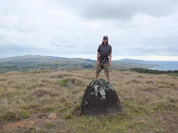
The next morning, while most of the tour group slept, I headed out on a morning bike and hike up to the caldera of Rano Kau, organized by one of the MIT free spirits on the trip (who has turned out to be the intrepid organizer and spiritual leader of additional independent recreational activities during the trip as well, including early morning snorkeling and pre-dawn star-gazing excursions—this was his first effort). Sorry for being so cagey on identities and not naming names for the members of the trip, but I just want to err on the side of caution in protecting folks’ privacy (though I may be going overboard on this, and completely sacrificing narrative flow in the process, but that’s the position I’m taking). Anyway, four of us, led by our local guide, Alvaro, biked it over to the foot of the volcano and hiked up a trail (apparently an old Rapa Nui ceremonial trail) to the rim. Here’s the view looking back at the town of Hangaroa (where our hotel was):

We hiked along the rim for a while, until we had to turn around to make it back in time for packing and lunch. Not super-strenuous, but a good way to take in more of the open island air and see the sights from a different vantage point. Later that afternoon, we would come back to the same volcano, but on the opposite side of the caldera (when visiting the site of Orongo Village); I’ll show pictures of the crater from that site visit.

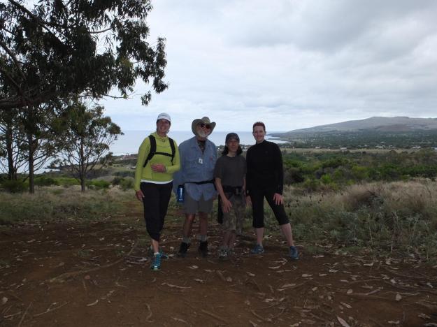
Here is the crew for this inaugural independent activity (sorry for the underexposure, I turned off the exposure bracketing to enable the fill-in flash, which somehow was also not enabled, thus completing the lose-lose on this shot, oh well…my fault, not Alvaro’s):

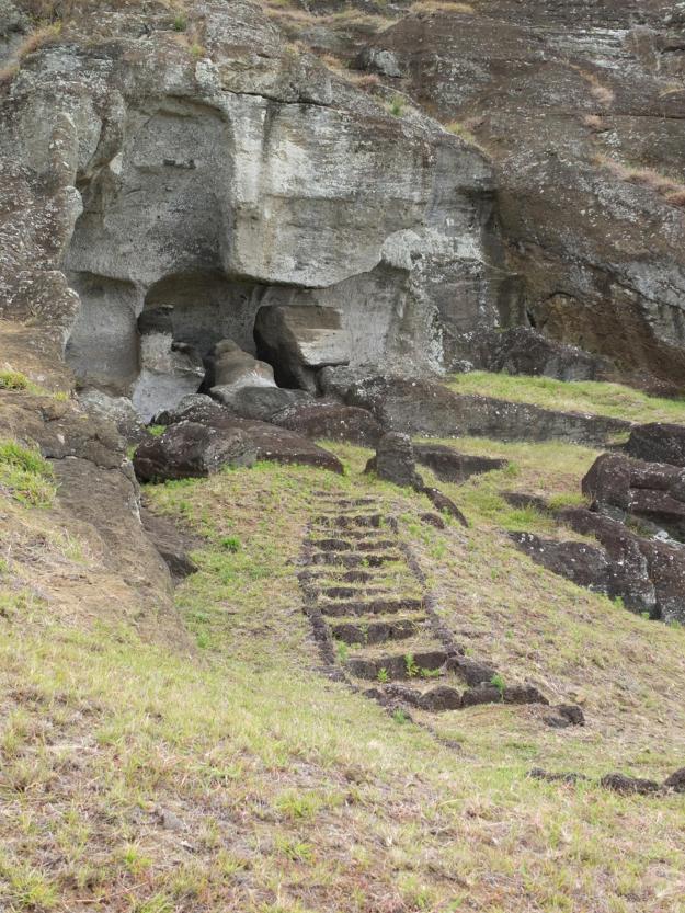
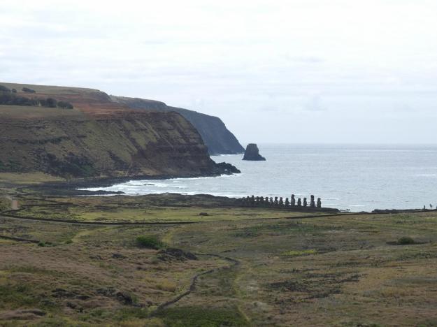
On our way back to the hotel, we stopped over at this site, a small rocky inlet, with a natural cave at the back of it.

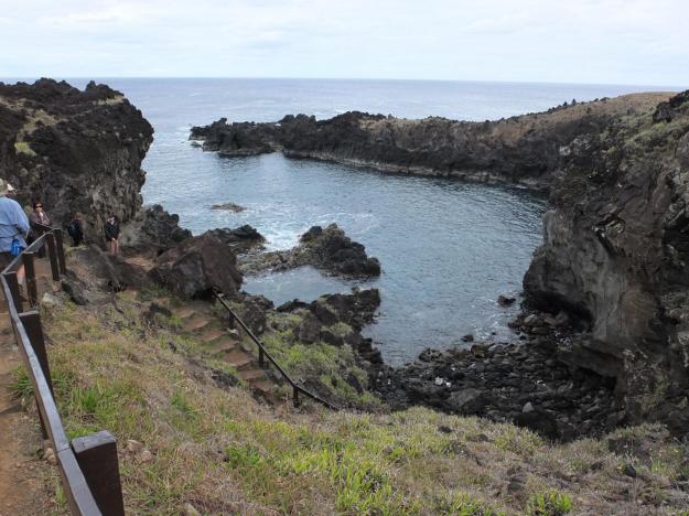
When the waves come in, they break in lively sprays of white foam over the small ring of rocks on the left-hand side of the inlet (center of the picture). We climbed down the set of stone steps and entered the cave, which is rocky and uneven and really quite shallow, and this is what we saw when we looked up at the ceiling:

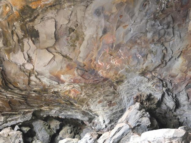
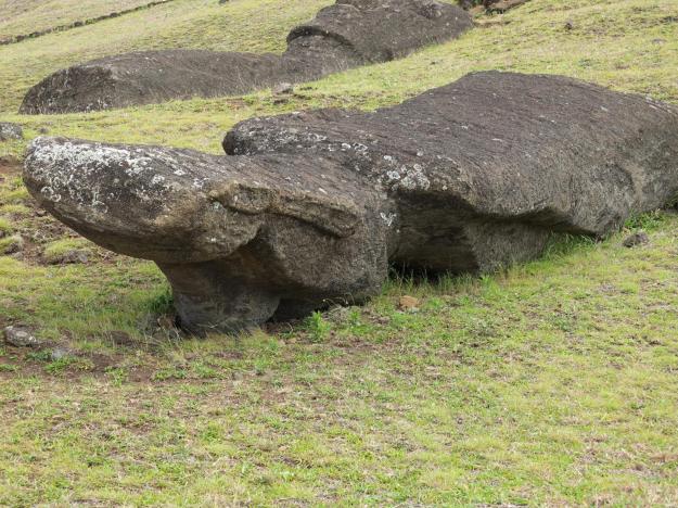
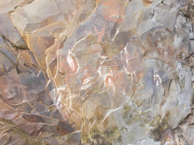
The animal figures, in red and white (and black?), were clear and quite expressive, even on the highly stratified surface, showing (I believe) the same iconography as the petroglyphs at Tongariki. It is amazing to me that the drawings are still visible, given the moisture and wind (the cave is not very well sheltered from the ocean), and occasional rushes of water that would flood the cave during storms, I would imagine. I didn’t stop to read the description posted at the site (for what it might be worth), so I don’t know if these are truly original drawings, and if so, from what era. Regardless, they somehow feel endemic to the place, despite (or perhaps accentuated by) their surprisingly good condition. Here is a closer shot for you to judge:

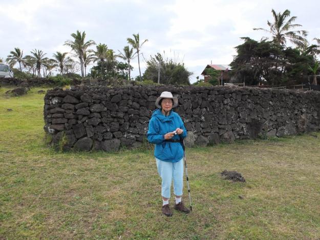
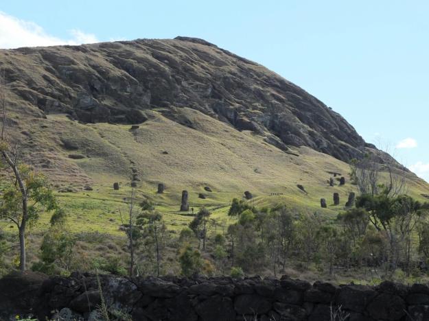
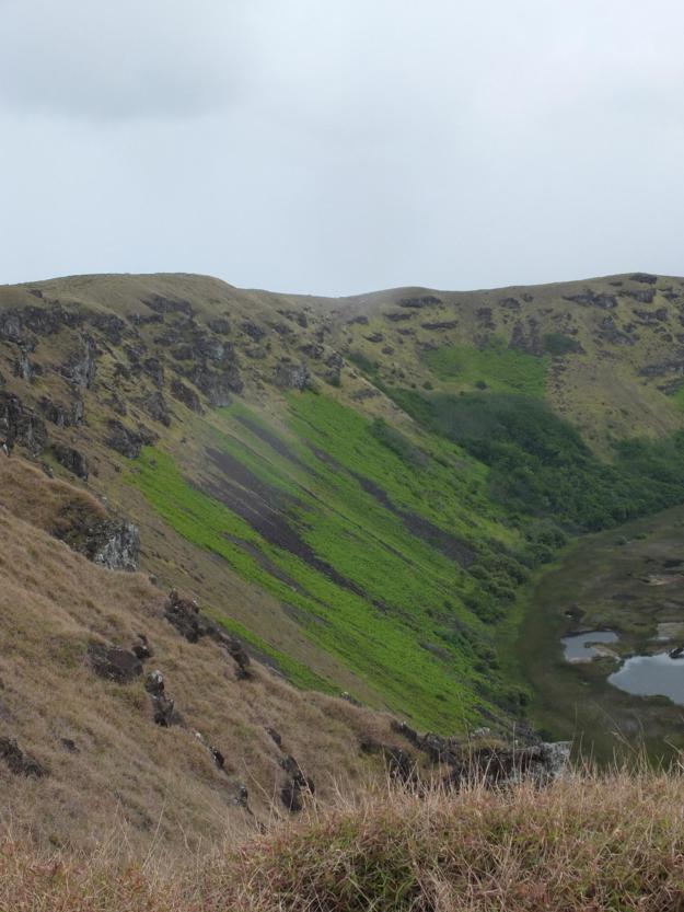
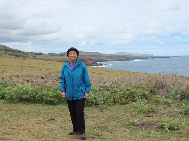
After lunch, we took a full group trip to the ancient village of Orongo, which was right next to the Rano Kau caldera, and the center of activity for the Bird Man Cult (which you can read about on wikipedia, among other places, though there is much varying information and interpretation of exactly how the politics and succession worked on the island—perhaps the true story can only be known through an old man’s dreaming). Here is Mom clowning it up a little on the edge of the spectacular caldera, close to Orongo Village (we had climbed up to the far opposite side in the morning):

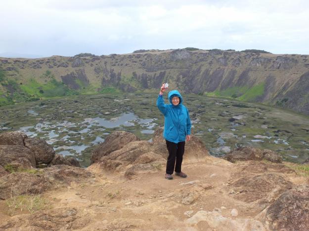
The crater appears nearly perfectly round, with an intact superscribed ring several hundred feet above the bottom of the caldera, above which are exposed rock outcroppings like castle turrets, and larger sheer rock slip planes like lookout towers. During periods of drought on the island, this was one of the few sources of fresh water; the natives carved steps down to the bottom, where they could collect the rainwater that had been trapped (not reabsorbing into the ground here).

The areas of light green growth that you can see lining the lower portion of the caldera in places, and extending down to the level of water, are actually expanses of grape vines. The story is that they were deliberately introduced by a French exploration team some time in the past, in the hopes of producing a wine crop.  They have not only survived, but have flourished in the intervening years, though the grapes are apparently not currently harvested. Here is a closer view:

As innocuous and whimsical a story as this seems, it is emblematic of the more modern (i.e. post-1770s European exploration) history of the island. Many plant and animal species have been introduced from a variety of origins, and for a variety of purposes, and the landscape and ecology and food chain have been perturbed, bastardized, and convoluted. On the one hand, perhaps a more robust ecosystem will eventually obtain (thus, cannibalizing the ultra-fragile ecosystem that had previously existed for thousands of years); but on the other hand, perhaps the magic of this place was actually the delicate balance of elements, and ebb and flow of rich and lean times, the cyclical near-death and rejuvenation of nature that gave birth to the spirituality and dedication to fantastical human efforts, going all the way back to its initial population in the first millennium AD.

Here is a picture of the dwellings at Orongo. Apparently these were used to house the participants for several months a year during the Bird Man Cult ceremonies in the later part of the pre-European explorer days.

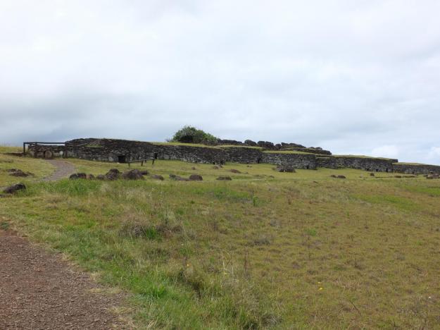
As mentioned before, these structures were clearly the model for the Hangaroa resort buildings, which have similarly rounded walls and grass-covered roofs (unfortunately, I don’t have any pictures of those). The entrances were low and the accommodations cramped (in the Bird Man Cult structures, that is, not the modern resort), and the construction of the load-bearing roofs and doorways, purely from the volcanic rock, was sophisticated, as this picture shows:

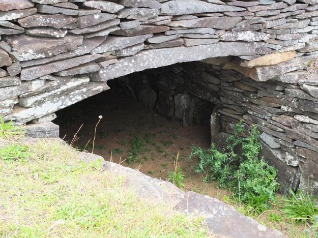
Of course, “sophisticated” does not mean perfect; Claudio showed us a structure in the complex that had collapsed and was never rebuilt, and underneath the stone from the fallen roof, was the crushed skeleton of a Bird Man Cult-era native.

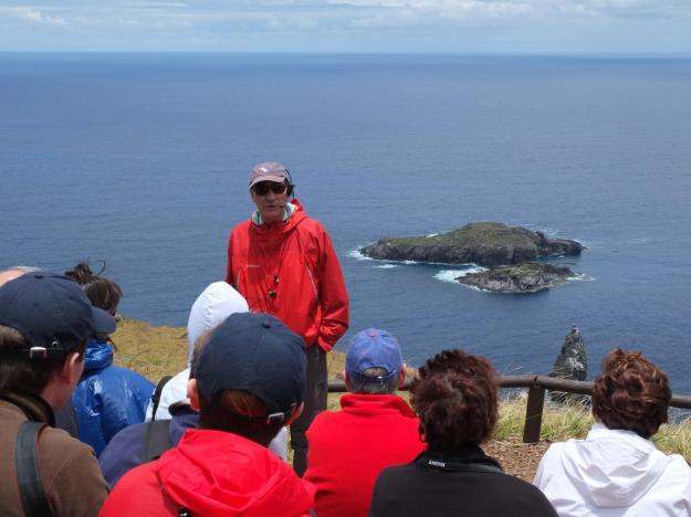
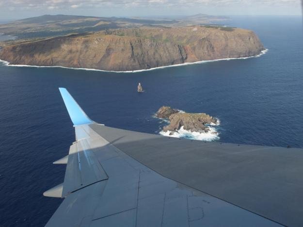
The other significant element of the Bird Man Cult ritual was the group of small rocky islets off the south-west coast of Easter Island itself, just opposite Orongo, consisting of two mostly flat (and barely occupiable) islets (a larger one and a smaller one), as well as a precipitous (not “precipitate”) rock spire thrusting up from the water, half-way between the occupiable islets and the main island.

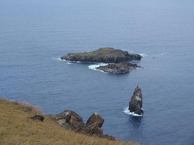
Here’s Claudio explaining to our group about the caves and dwellings and other remnants of the Rapa Nui presence and doings found on these islets:

And here’s a shot from the other direction during our initial fly-around of the island, that helps put the scale of the locale in perspective:

I don’t have time or space right now to recount all that I remember from the excellent information and interpretation given us by our scientist guides, and as previously indicated, I believe it would be a disrespect, and probably a disservice, to usurp their stories, and to do it incompletely and ingenuinely [to coin a decently descriptive, if sub-elegant, word]). You’ll have to sift through conflicting and mostly speculative other descriptions of the ritual that occurred here, and try and weave them into a semi-coherent picture, at least until Claudio (or a scientist like him) is able to coalesce and publish the accumulation and refinement of decades of diligent discovery, research, and analysis, and set a new and credible baseline of understanding of the Rapa Nui people, their history, and their traditions.

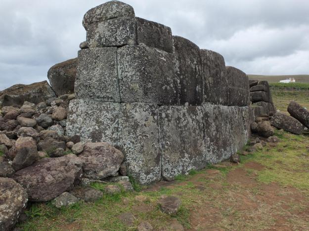
The final site we visited before leaving the island was Vinapu, on the eastern shore near the end of the airport runway, and not far from Rano Kau. Take a look at the construction of this wall from the site and tell me the first word that comes to mind.

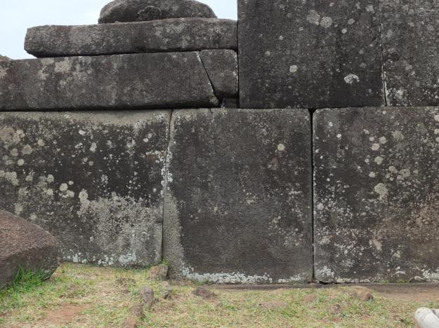
That word better have been “Inca” (if not, then either you’re not paying attention, or I need to post another dozen close-ups of rock joinery from Machu Picchu, if you can take more of it). That was also the word that occurred to Thor Heyerdahl, the ethnographer exploring the island in 1961 or so, who proclaimed that this was clear evidence that the Incas were the original settlers of Easter Island. This, of course, is easily debunked, according to Claudio Cristino and others, who cite, among other reasons for discarding this conclusion, constructional differences and ocean-navigational impossibilities (their word) in making the alleged journey from Inca territories.

To Heyerdahl’s credit, he sought to perform a comprehensive scientific analysis of the site, including a detailed investigation of the engineering techniques. To get access to the interior elements of the structure, in a moment of paradoxical, and presumably bi-polar, reconstructive/deconstructive fervor, he blasted open part of the wall with dynamite.

I hope he got what he wanted out of the blast, one way or the other.

Here is one final shot of the iconic volcanic terrain and gorgeous coastline of the island, just before we headed back to the airport and the plane (whose registration I know now is “Gulf Oscar Oscar Bravo Foxtrot”, or “Bravo Fox” for short, as Captain Jon and the flight crew call her).

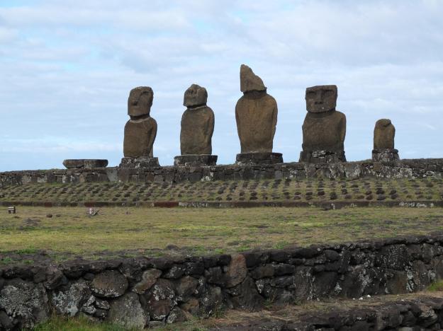
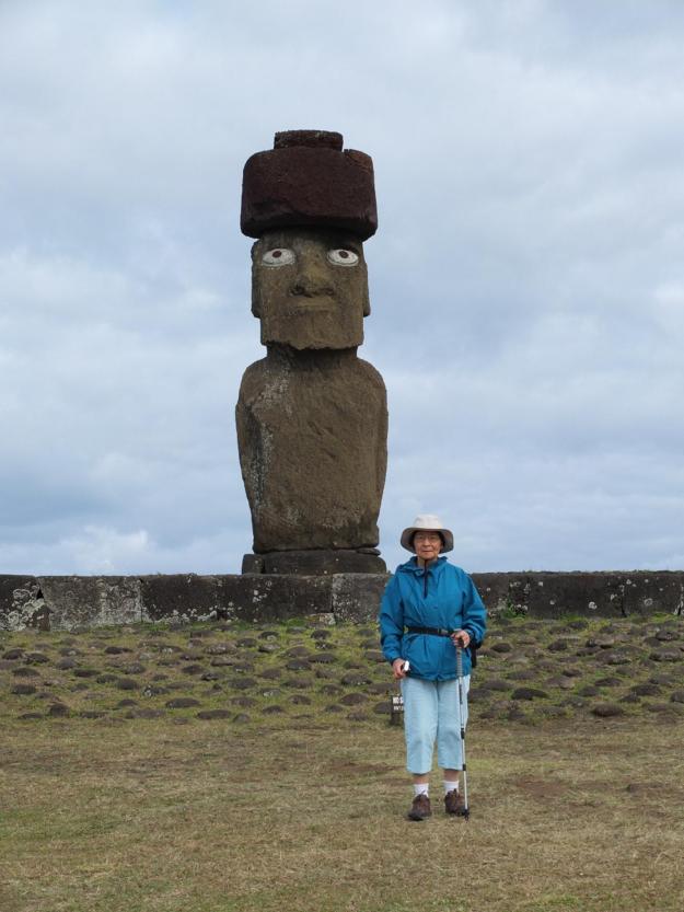
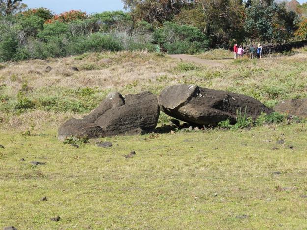
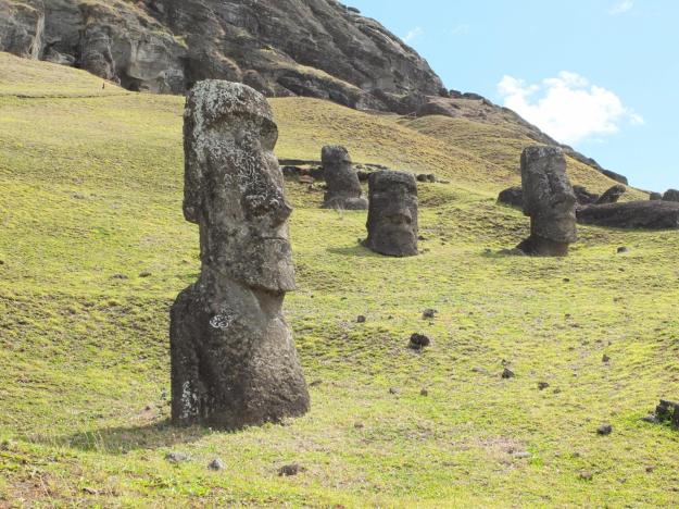
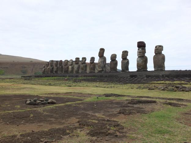
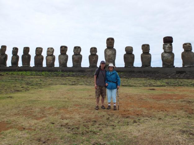
The statues at Easter Island are indeed a phenomenon to see and to experience up close. But the wonder only begins with the viewing of, and proximity to, the Moai—it continues with the walking around and between and among them, and heightens with the unbounded imagined portrait of the old Rapa Nui people and the conditions in which they lived, and culminates with the body-permeating mana (ancestor spirit) emanating from the other-worldly legacy left us by those from a reverent and alien past.

My thanks goes out to the scientists and researchers and scholars who continue to further our understanding of this important and wondrous place, and to our guides who are able to walk us through it in such a thought-provoking and fitting manner—all of them (overlaps included) humbly serve the continuity and evolution of the human family through their effort. Our conversation with them will continue.

Easter Island and the Archaeologists

November 6th was a travel day. One hour flight from Cusco to Lima, hang out in the International Terminal VIP lounge (food, drink, TV, internet, comfy chairs, isolation from riff-raff [of which I was a former member], etc.—all very nice) until our flight was ready, then a five-and-a-half hour flight to Easter Island. Before we are allowed to eat lunch on the plane, this is what we have to endure:

This is a really rough way to travel. Five-and-a-half hours goes by like nothing, though pleasant meals, nice wine (“Another Bolly, Mr. Tung?”), and lectures by our resident experts leave insufficient time for blogging (which I’m still no good at, as my recent rate of posts reveals—I’m already about week behind, though in my defense this International Date Line thing is making it look worse than it is, by approximately 16.67%).

On the way in, the captain did a low fly-around of the entire island, actually for both sides of the plane, showcasing the inland volcanic domes and the stunning caldera at the south-west corner of the island (pictures to come later), as well as the beautiful coast (see aerial view in the headliner of the blog today). I don’t think United Airlines does this type of thing, maybe I should get a new mileage card.

We stayed at the newly reopened Hangaroa hotel, which presents itself as a “green” resort. The buildings have living roofs (which drip streams of water in the morning), there are separate organic and non-organic trash bins (neither of which got much use from us, either for or against the environment), and lined up on one end of the property (in a prominent location when viewing the sunset) are a handful of ten-foot poles, each with a small solar panel and wind turbine on top (not super-sure they could recharge an iPhone, collectively). The most interesting thing about the resort (other than overall comfort and sub-tropical décor, which was all good) was the shape of the buildings, which echoed the houses at the Orongo site (again, pictures to come, along with a little of the story for context).

The first site we visited the day after arriving was Tahai, which is actually a location down by the western coast of the island with three distinct “ahus” (which are the platforms on which the Moai—those iconic statues—stand). Here was our first view of the site—actually, our first view of any Moai—with Ahu Vai Uri (the five figures) and Ahu Tahai (the one) in the frame, very striking and moving.

In addition to the statues, the Rapa Nui people of the island also built many stone houses and walls, as well as co-opting caves in which to live (or stay for extended ceremonies, or sometimes seasons). Many of the houses were partially underground, with low entrances into the tight spaces; it’s hard to image how they could possibly live within them. Here is Mom standing next to a wall at the site. Note the relatively primitive construction, at least compared with the Incas (more on that later).

This is a closer shot of Ahu Vai Uri, with a clearer view of the platform details, as well as the inclusion of a wall used to delimit a ramp into the water (which actually may have been built by Europeans exploring/exploiting the island). There was clearly a sixth Moai on the left-hand side, whose body and head are probably missing (I don’t know the details of that dude, since I was probably wandering when the guide was explaining).

Note that all of the Moai on the island were knocked over sometime prior to the arrival of Captain Cook and other Europeans in the 1770s. Many of the statues, here and elsewhere on the island, were damaged due to the original vandalism (or repudiation, or whatever the knocking-over should be called as part of rebellion or in-fighting or “civil war”, as some call it [though that sounds like an overstatement to me]), in addition to showing significant wear from weathering over the years as well as discreet acts of tsunami, etc., hence misshapen and/or missing heads.

This is a picture of Ahu Ko Te Riku, which is on the north side of the site (or off to the right, in these photos). This is a Moai with the head piece attached, which is believed to represent the style of wrapped and tied hair previously wore by the natives (or maybe only their spiritual leaders), as well as the eyes made of obsidian and coral.

There are a number of head pieces that have survived, I am not sure whether all of the Moai had them originally. The addition of the eyes really makes the statue come to life; they were apparently used to imbue the statues with the spirit of the ancestors when the statues were originally erected. I believe these eyes were constructed relatively recently (i.e. not original), I don’t know if any of the original eyes survived. I also think that eyes were typically not left installed, but only used in the initiation process for a Moai. Note that I will allude to many uncertainties regarding the statues and the Rapa Nui people, this is partially because there is much missing information in the history of the island (i.e. much archaeology to be done, and much lost forever), partially because there is much debate and speculation (and much misinformation) about the artifacts and structures excavated and reconstructed, and partially because (as stated before) I don’t always pay attention in class. You can make up for the last reason by perusing the wonderful internet. More about the first two reasons later, when I talk a little about the archaeologists.

The next site we visited was Rano Raraku, which is one of the three volcanoes whose combined lava flows formed the island. On the south and south-east sides of the volcano is the basalt quarry from which many (all???) of the Moai were carved, released from the mountain, and transported to their final locations (with the finer details often finished on or near the ahu). This is an amazing site. You can see many dozens of Moai in various states of completion, some still attached to the quarry, some completed (presumably ready for transport), and some tumbled and broken during the process of releasing from the mountain.

Here is one whose head has snapped off from the body, lying at the bottom of the mountainside.

Ironically, many of the Moai that were installed on various ahus and then knocked over, also lost their heads, but archaeologists re-attached the heads with steel bars and cement in resurrecting them. The damaged ones here at quarry are clearly going to be left as they are, to freeze in time the moment that the work stopped in the construction of the Moai (and not the moment of their later destruction).

There are many statues seemingly completed that are scattered throughout the site, though I don’t know why or how they ended up buried to varying depths like this.

And here’s a view of a statue midway during the carving process. As Michelangelo would say, the Moai is already lying on its back fully formed within the rock, and the Rapa Nui just have to carve out the stone around it.

Here’s a view from the quarry to the famous Tongariki site, with its fifteen Moai, a little less than a mile down toward the south-eastern coast of the island (we’ll see these closer up shortly, when we go and visit that site).

Here are a couple more shots of the quarry. The first has two figures left in postures that say something significant about the story of their carving and ultimately their abandonment (too bad we don’t know what that “something significant” really is—perhaps the closer one was kidnapped and released upon payment of a ransom of chickens, or possibly recently returned from war, in either case kissing the basalt hillside of his origins upon returning home).

And the second is a shot back up the slope of the quarry.

DSCF1423 (1280x960)

It is hard to tell from the picture, but when you are there, you see faces of the Moai in nearly every surface of the exposed basalt. Some are perhaps initial rough cuts or general excavation/shaping of the quarry, others are purely imagined—Moai in repose, fully embedded within the rock, waiting patiently to be carved out and released. It is this latter group, the imagined Moai, that the Rapa Nui people also saw and freed from the rock and gave life to.

From the quarry at Rano Raraku, we drove down to the site at Tongariki. Here’s a closer view of the fifteen Moai.

Note the ring of rocks on the lower left-hand side, they guard a flat surface on which the petroglyph of a turtle was carved. Here’s a picture of the glyph from Mom’s camera:

This site has an amazing recent history (of which I will get most of the details wrong, but the gist will be okay). Around 1960, there was a granddaddy of a tsunami (thousand year tsunami) which ravaged this coast of the island. This ahu and its Moai were slammed and all of the rocks at the site were upended and washed about and strewn across hundreds of yards going inland, leaving a uniform field of debris several feet deep. When it came time to repair the site, and re-gather the pieces, and re-place and re-stand the statues, they actually turned to photographs that had been taken as part of early scientific surveys of the site (sometime like the 1910s or 20s or so). From those pictures, they identified all of the pieces that comprised the ahu and its statues, as well as the original construction, and the original placement of all of the Moai. They painstaking located all of the pieces and built them up, an effort of 50 people working full time for five years.

There were also several single Moai on the site, not situated on the ahu, but rather on their own smaller platforms. One of them had its head separated from its body by the tsunami, but rather than reassemble and re-stand it, they decided to just bring the head back to where the tsunami had carried the body—both reuniting the parts of the Moai, as well as acknowledging the effect of the tsunami on the history of the site. These stories were told to us by Claudio Cristino from the University of Chile, the archaeologist who led the post-tsunami reconstruction effort sometime in the 1990s. The funds for the project were provided by a Japanese company in appreciation (a nice word for payment) of the loan of one of the lone Moai from Tongariki (now returned to the site). It was absolutely amazing to get a walk-through of the archaeology and the unvarnished scientific understanding (distinguishing between the known, the merely suspected, and the completely unknown) of the site from the scientist most intimately involved with the research around it.

Someone from the group asked him if there was a way to prevent the next big tsunami from washing away the current rebuilt installation, and he said “no”. There was no sorrow and no angst associated with his answer, it was just matter of fact. He was comfortable with participating in discovering the history and the secrets of this site (and others), furthering our understanding of the people who originally built it, and presenting it in such a way that it could spark other people’s imaginations and wonderment, even if just for a brief period of time (until the next big one). Later that night at dinner, I told him that his inner peace with the transitory nature of his work reaffirmed to me that the archaeological process is not just uncovering the history of people and places, but also contributing to it. I told him that it reminded me of the dichotomy of the archaeologist’s role in history put forth by Belloq in the first Indiana Jones movie: on the one hand, when he is about to bury Jones in the Well of the Souls he says that Jones will now be a permanent addition to the archaeological find (thus participating in, or even shaping, history); and on the other hand, he says that the two of them, as archaeologists, are just passing through history, whereas the ark (or in our case, the Moai), “this is history”. Claudio was not offended, I think he recognized the compliment (in both interpretations of the role). Claudio was also our guide for several of the other site visits over the day and a half we were on the island; his knowledge and insight and overall understanding of the Rapa Nui narrative made the place—with its 1200 year history, through to the present day—a true living-and-breathing testament of human ingenuity, determination, and spirit.

There is a lot more about Claudio and the scientific effort on Easter Island that I would like to say, but probably will not have the time for during the trip (just a few scattered, hopefully cogent, references is the best I can do for now).

And to lighten things up after those heavy thoughts, here’s the obligatory tourist picture from the site (since we haven’t seen one in a while) to prove that we were really there (though, of course, photos prove nothing these days):

After lunch at Anakena Beach, a beautiful white sand beach set in a small bay with clear blue water (which was also an archaeological site, with Moai), we headed toward Ahu Akivi, also known as the “Remote Moai” location. This was the first Moai site on the island that was fully excavated (in the early 1960s) and rebuilt.  Trenches were dug around the ahu to uncover clues about the generations of builders and inhabitants and worshippers, and how they lived and celebrated (or sacrificed). The ahu hosted seven Moai, which were repaired and re-stood up. And in keeping with the theme, our guide for this site visit was one of the key members of the 1960s archaeological effort, Edmundo Edwards.

This site was unique in several regards. First of all, it is inland, about a mile and a half from the north-western coast (all of the other sites we visited, and all of the other sites I see on the map, are along the coast). Secondly (and probably related), the Moai here face the ocean rather than facing away from it. I believe the current thinking is that the Moai represent the spirits of the Rapa Nui ancestors, who look out over the current inhabitants and protect them. In this site, there are remnants of ancient houses and agricultural fields behind the Moai, but perhaps the main population of the area lived between the statues and the sea.

As with Claudio, I truly appreciated hearing about the excavation and deciphering and reconstruction of the site from Edmundo. He said that during the excavation, they had uncovered evidence of cannibalism: dismembered human remains that were clearly part of a feast of some sort. He said that he had taken the evidence to the lead, and pioneering, scientist for the effort (and mentor of both Edmundo and Claudio), William Mulloy, who indicated that he should leave the information out of the report for the excavation. Later, similar evidence in other sites was uncovered, and cannibalism among the Rapa Nui is now an accepted part of their history, though the context and meaning is still unknown. In an interesting twist, I later asked Claudio about the initial burying of this information, and he thought it very unlike that Mulloy would have done such a thing (though he tactfully added that Mulloy may have suggested that it not be the lead topic for the report).

Edmundo also told a funny story about a crusty old native who approached the archaeology team as they were excavating, telling them that he knew exactly who the seven statues represented, and all about the story behind them. That seemed to be exciting news to the team, but Mulloy was uninterested in the old man’s claim, and pawned him off on Edmundo, who then listened attentively to the old man’s story of the seven brothers (“emissaries”) that formed the original Polynesian migration. He jotted down every detail in his notebook. When he asked the old man what the name of the seventh brother was, the old man paused and said “Jeovanni” (which incidentally, if you will remember, was the name of one of our guides in Guatemala). Edmundo said that was impossible, but the old man insisted. When Edmundo asked him how he knew, the old man said that was exactly the name from the dream he had the night before, at which point Edmundo knew that Mulloy had read the old man exactly right, and that all of the notes he had just taken were total garbage. The kicker to the story is that the old man went into town several days later, telling the story of the seven emissaries at Ahu Akivi to anyone who would listen, and today the plaque at the site, issued by the park service, echoes that same story.

Edmundo was actually quite a character, who told excellent and entertaining story after story during his tours, both about his personal experiences on Easter Island, as well as making the history of the Rapa Nui people, as he and his research currently understood it, really come alive. But, as I learned from the Anangu people of Central Australia (i.e. the aborigines), they are not my stories to tell, so I will have to allow Edmundo, alone, to pass those on in the proper way.

Note that Claudio and Edmundo, along with Claudio’s ex-wife, Patricia Vargas (also one of our guides on the island), appear to be the most prominent researchers currently on Easter Island. I see them consulted and quoted in most popular (and probably scientific) write-ups and presentations on the island’s history. As good as our guides were in Guatemala and Peru (from local tour companies, contracted by TCS, our overall tour company), it is really an incredible privilege to be guided and instructed by the researchers in the field, an outrageous treat.

That night back at the Hangaroa “Eco-Lodge”, we had a gathering that included our private jet airplane crew, the three scientists, and our other guides (including a son and a daughter of Claudio and Patricia, I believe—I didn’t really get to meet them, since I was tagging behind Claudio and Edmundo so doggedly). There were lectures by Claudio, Edmundo, and Patricia, and a performance by a local dance troop (which Mom has pictures of). During dinner, I noticed that Claudio was sitting alone at a table outside (though people were stopping by and talking to him); I mentioned it at our dinner table, and one of our highly sympathetic travel companions (fellow MIT guy) asked Claudio to come join us. He came over with a bottle of wine in hand, and I talked to him for something like an hour and a half or two hours (or measured another way, four-fifths of a bottle of wine). He was proud and enthusiastic about the work that has been done, hopeful about the work yet to be done, wistful about the difficulty in balancing so many different and important efforts, mournful about the state of funding for serious organized and comprehensive research on Easter Island, and downright angry at the irresponsible and unsubstantiated (or outright wrong) things that have been published by popular (and even scientific) books, magazines, and documentaries. As I mentioned, I have more to say about the archaeologists, I will find the right time to sort it out and write it down properly.

This was the end of day one at Easter Island, I’ll cover day two in the next post.